By Gretchen Wehmhoff
The Taiya River, just a valley over from Skagway, was rising. The National Weather Service warned Northern Lynn Canal residents that rain was possible, and in combination with seasonal melt off, flooding in lower elevations was imminent.
In less than 48 hours, the Taiya passed flood stage on Aug. 12. By the next morning, the river was heading toward a predicted cresting of over 18 feet. It would, in fact, crest at 19.19 feet, just inches below its record 19.86 feet set July 23, 2002.
Skagway Police Chief J.J. Reddick watched the alerts and headed out to Dyea on Friday to check on residents. The river was high near the road and as he crossed the bridge over the Taiya, roads were beginning to fill with water.
Reddick stopped by John and Lorna McDermott’s house, located along the river. He and McDermott walked around the house where water was coming from the river into his yard. McDermott was confident his home would be fine, although, according to Facebook reports, he did see high levels of water in his garage.
McDermott said later that he and Lorna are well and they are grateful for the community keeping an eye out both before and after the river crested. He said he had a fair amount of help from friends and family, but all was good at their home.
Reddick headed to the Dyea campground to assist the campground host in clearing the area. The host was packing her vehicle to relocate back to town. She and Reddick did a last check.
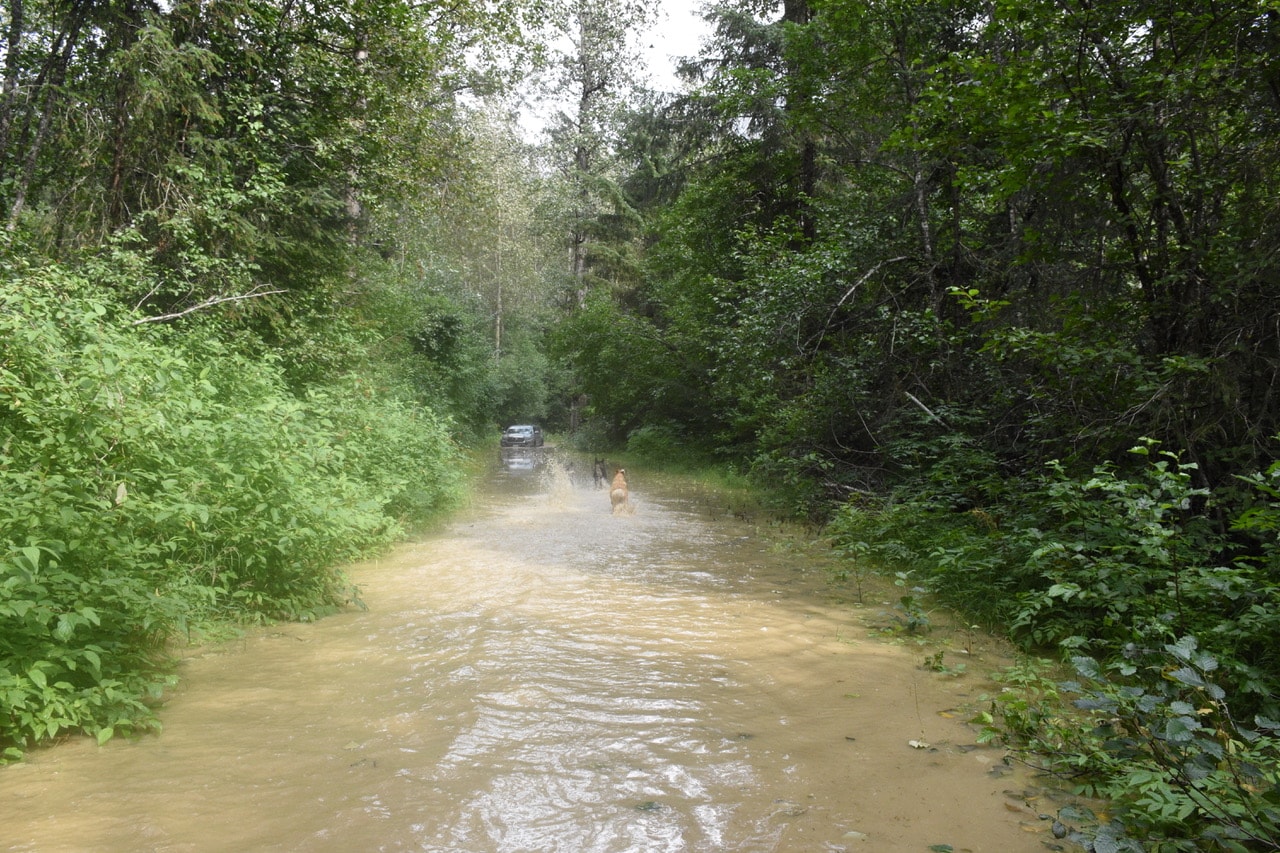
The campground had already been closed due to the river encroaching on the campsites. The fast water had eroded two campsites in July and was feeding on more as the water rose. The road to and from the area was already under water.
Jeff Brady talked with Reddick when he dropped by. Dorothy and Jeff Brady’s home seemed to be doing well. It hadn’t fared well 19 years ago when the river hit its record crest in 2002. That event, caused by the collapse of the West Creek moraine, sent four feet of water through the yard, moving one building 100 feet and filling up other cabins with water and silt.
Brady said that most likely wouldn’t happen again after mitigation projects were completed.
“The city did not wait for state disaster money; they went to work at putting in a dike below the West Creek falls to protect residents out here. So far, so good!” said Brady in a Facebook post.
The dike held, and the Brady home stayed dry.
Brady and McDermott gave regular weather and river reports on the Skagway, Naturally Facebook page.
Brady lives just above the confluence of West Creek and the Taiya River. He reported that the lower falls above his place was high with some water splashing over and through the dike, but flowing back into the river. The campgrounds at the confluence were under water and the road to the raft launch area was flooding and flowing into Brad’s Road, an area Brady says locals call the backwater slough.
Brady said the slough was “choked with salmon” and shared a video on Facebook of his dogs entering the water trying to catch a few.
Reddick continued to knock on doors and check on residents.
The Klondike Gold Rush National Park Service (KGRNPS) had already closed the Chilkoot Trail to hikers. Reddick checked in with the park rangers as three hikers showed up at the trail head at 6 p.m. They were soaked, but in good shape after hiking five to seven miles through ankle to waist high water. No other hikers were reported to still be on the trail.
According to witness reports, areas in Dyea that were not normally in the path of the river were seeing flooding this time.
Reddick and others reported the water was encroaching on the Slide Cemetery and other forested areas that don’t historically don’t see flooding.
This pattern seems to correlate with the path of the water after the 2002 West Creek moraine incident — most noticeably the fast rise and the rapid recession of the water. A local who had been around for the 2002 incident noted that floods caused by rain and melt-off usually rose and retreated in a steady manner. This flood event had the river crest, then fall back at a faster pace.
A few people with extensive knowledge of the area theorized there might have been some slide damage above the park service’s Sheep Camp. The hypothesis follows that a suspected rock slide could have temporarily blocked water from the river, but the current’s strong cubic pressure eventually broke through, resulting in the rapid rise and fall of the water within 24 hours. An event like that is called an outburst, or a sudden flow of water down the river. The possibility of an outburst event is being discussed, but can’t be confirmed without extensive review of the area by air and on-site evaluation.
Jason Verhaeghe, Interpretation and Education Division Manager for KGRNPS, confirmed that there was some damage to the public camp at Sheep Camp and the trail crew camp. The park service is currently ascertaining the extent of damage and cost for repairs. He also mentioned that the park road received flood damage, but is still passable. The eventual cost and report of the road damage will come after further investigation.
Cory Thole witnessed the flood activity and the rapid rise of water that Friday. He was reminded of Christoper Robin in A.A. Milne’s story of Winnie-the-Pooh, who didn’t mind the weather as long as he was in it. Perhaps Dyea could relate to another quote by Winnie-the-Pooh.
“And really, it wasn’t much good having anything exciting like floods, if you couldn’t share them with somebody.”


Leave A Comment